
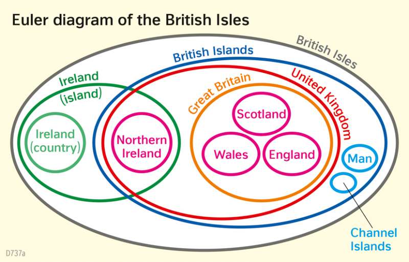
Euler diagram of the British Isles
Industrial Age
978-3-14-100890-6 | Page 84 | Ill. 1
Overview
The British Isles is the name given to the entire group of islands lying in the North Atlantic and pictured in the physical map. The British Isles consists of Ireland and the British Islands. Ireland, the island, is divided into Ireland, the country, and Northern Ireland, which is part of the British Isles and the United Kingdom.
British Islands as part of the British Isles
The term "British Islands" is used for the United Kingdom, the Channel Islands, and the Isle of Man, which are under British sovereignty. However, the Channel Islands and Isle of Man are not part of the United Kingdom (UK), which is made up of Northern Ireland and Great Britain. Great Britain, with its capital London, can in turn be divided into the individual countries of England, Scotland, and Wales.